USS Abraham Lincoln Confirmed Sailing in Indian Ocean Bordering/Crossing CENTCOM AoR
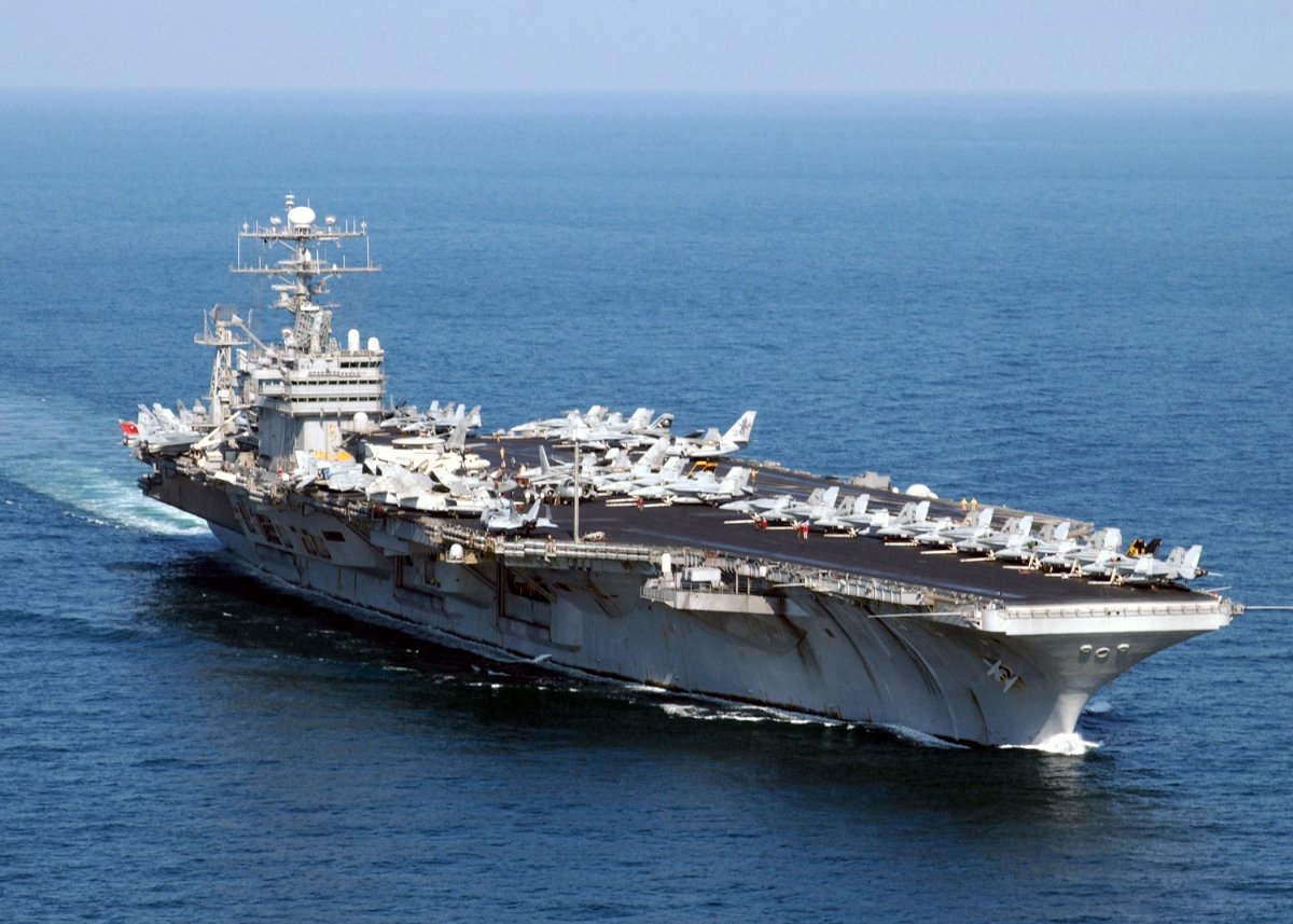
MIDDLE EAST - U.S. Central Command confirmed the USS Abraham Lincoln aircraft carrier is sailing in the Indian Ocean on January 26, as part of its deployment to the Middle East to promote regional security and stability.
This update comes amid Iran’s suppression of nationwide protests and riots that erupted on January 8, resulting in estimates ranging from 3,117 per state media to over 36,500 according to activist groups. President Donald J. Trump announced on January 13 that aid was forthcoming for protesters.
Iranian authorities imposed a near-total internet blackout and suspended visual flight rule operations nationwide from January 26, signaling heightened security measures.
The U.S. Department of State sanctioned entities facilitating Iran’s petroleum trade on January 15, aiming to pressure the Iranian government.
The Carrier’s Current Position
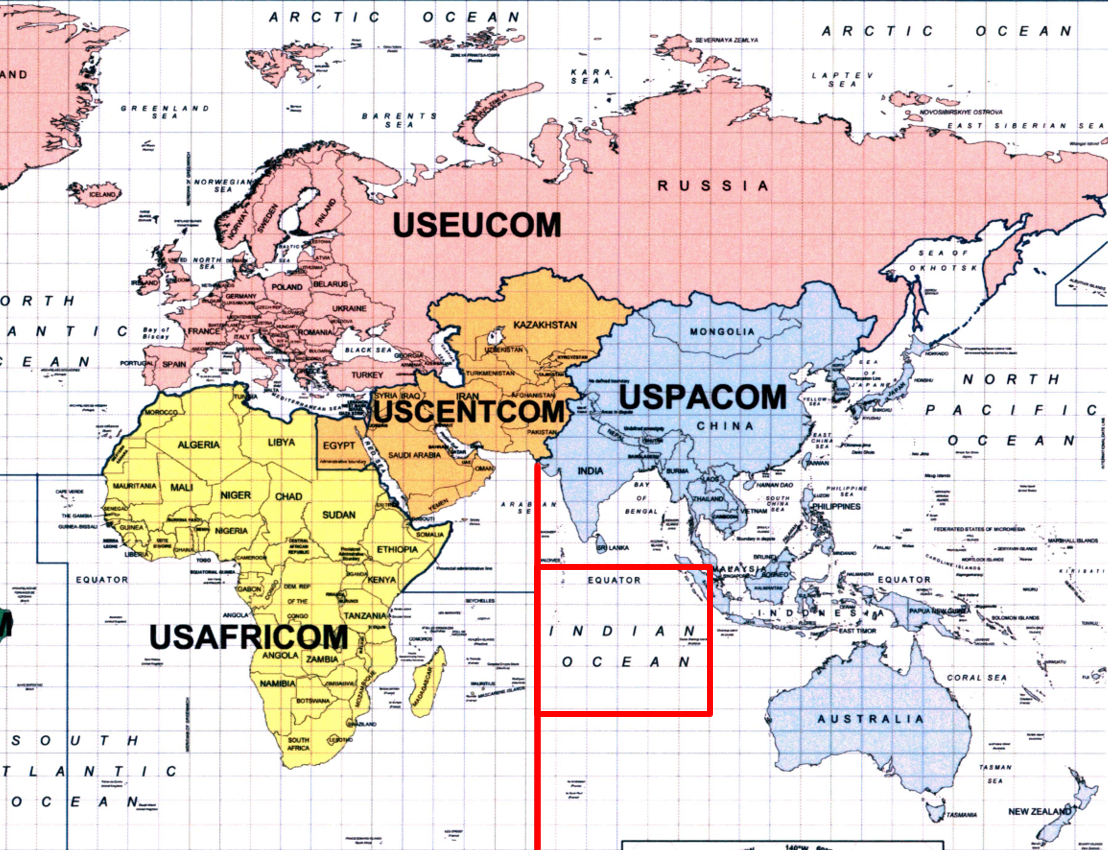
The carrier’s position in the Indian Ocean places it en route to the Arabian Sea, bordering the Middle East. The attached map of U.S. Combatant Commands illustrates the boundary between USPACOM and USCENTCOM areas, with the Indian Ocean under USPACOM jurisdiction. This indicates the group has not yet entered USCENTCOM’s Middle East area of responsibility.
Protests and riots in Iran, triggered by economic grievances, faced a severe crackdown on January 8-9, with security forces deploying live ammunition and militarized units.
Opposition reports documented mass arrests and extrajudicial killings, while the government imposed communication restrictions to conceal the scale of violence. Amnesty International noted on January 8 that the response involved heavy weaponry, marking one of the deadliest suppressions since 1979.
U.S. sanctions targeted illicit petroleum networks on January 15, as part of efforts to isolate the Iranian government economically. Congressional hearings on January 12 discussed potential U.S. interventions, cautioning against strikes that could undermine diplomatic channels.
Full report for paid subscribers
The free version ends here. Paid subscribers get the complete report: the analysis and, depending on the event, source documents, intel screenshots, transcripts, video or notes.
Read the Full Report (Paid) →Paid subscribers get the full reports on Substack. Many of our alerts, plus the live readiness levels and maps, are posted only here on Defcon Level, free.