Tanker Incident With Military Forces Off Muscat
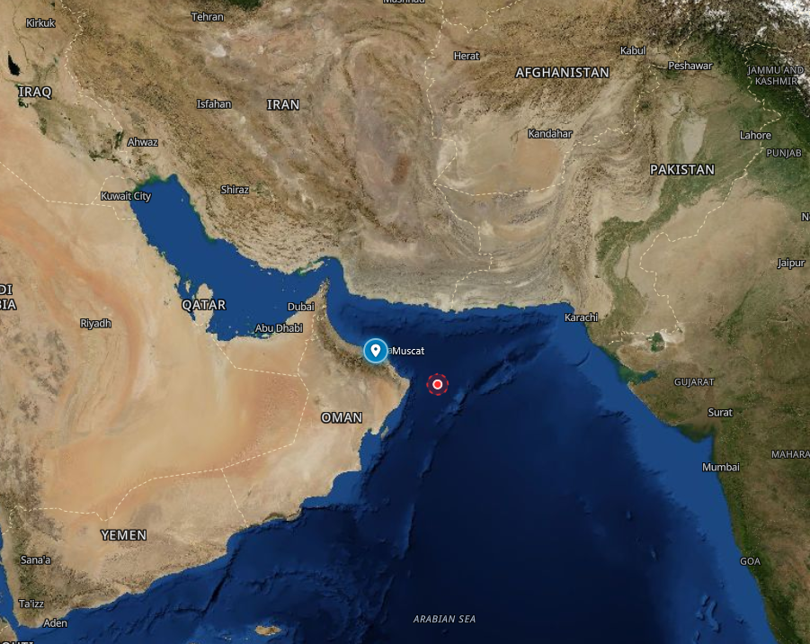
Credit: Map credits: Open Street Map, Modified Copernicus Sentinel data
INDIAN OCEAN — On August 31 the United Kingdom Maritime Trade Operations (UKMTO) published Advisory 123-26 after a ship’s Captain reported an incident involving a tanker and military forces in the Indian Ocean.
The report gave no vessel name, flag, International Maritime Organization number, course, or crew status, and no latitude or longitude for the contact.
The accompanying map marks Muscat, Oman, and draws an unmarked circle in the water east of the city. UKMTO categorized the notice as an Advisory, not as a Warning or an Attack.
According to the report, authorities are aware of the incident and that investigations remain ongoing. It tells other vessels to use current maritime security information and to stay aware of the operating picture.
It does not describe a projectile, a fire, a boarding, a redirect, or casualties.
Locations Affected
-
Muscat, Oman, 23.58, 58.41 (approximate city point from the advisory map pin, not an incident coordinate). UKMTO uses this mark as the only named place on Advisory 123-26.
-
Unmarked circle in water east of Muscat, in the area UKMTO labels the Indian Ocean. No official latitude or longitude has been published for that circle, so it carries no map pin of its own.
Official Statements
-
United Kingdom Maritime Trade Operations, Advisory 123-26, August 31: “UKMTO have received a report of an incident involving a tanker and military forces in the Indian Ocean. Vessels are advised to consider the latest maritime security information and maintain awareness of the evolving operational environment. Authorities are aware and relevant investigations remain ongoing.”
Full Report & Analysis
The full report includes expert analysis and risk assessment.
Full Report & Analysis →